- Pick a track from the Cyclograde catalogue, or import your own GPX file
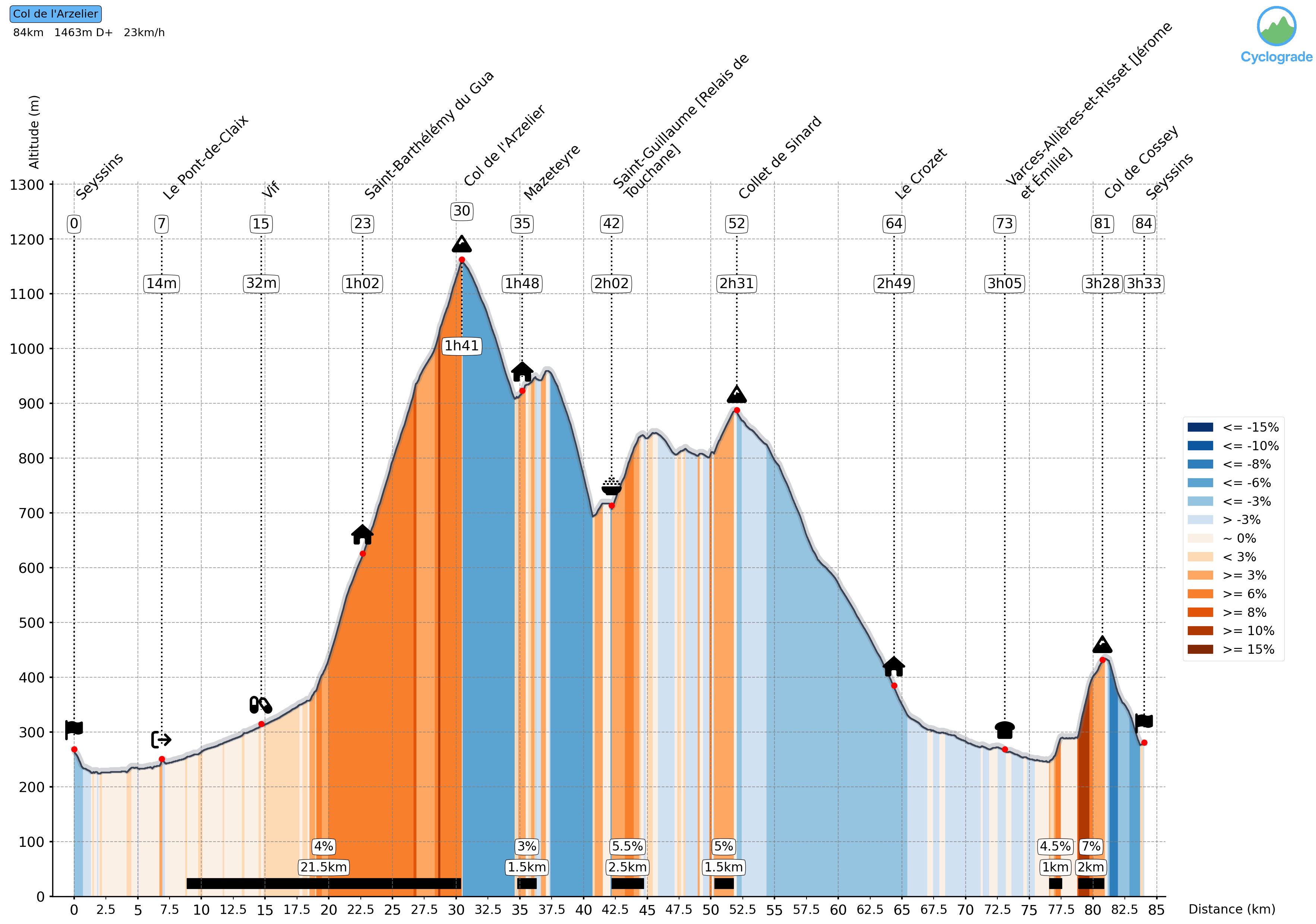
- Generate your personalised elevation profile
- Print your profile, or keep it on your phone
- Ride with your profile out on the road
- Publish your profile on your favorite platform
Your elevation profile and your ride time, calculated for your level
Cyclograde builds a complete profile from your GPX file, with your estimated time at every place along the way — calculated for your level.
Sign up
Sign up to keep your tracks, get into the track catalogue and customise your profiles.
Create a track
Try it with your GPX file, no sign-up needed
How does it work?
The major sportives are already in Cyclograde
Cyclograde comes with a catalogue of tracks, from sportives to open rides.
With the catalogue there is no GPX file to supply: pick your event and generate your own profile.
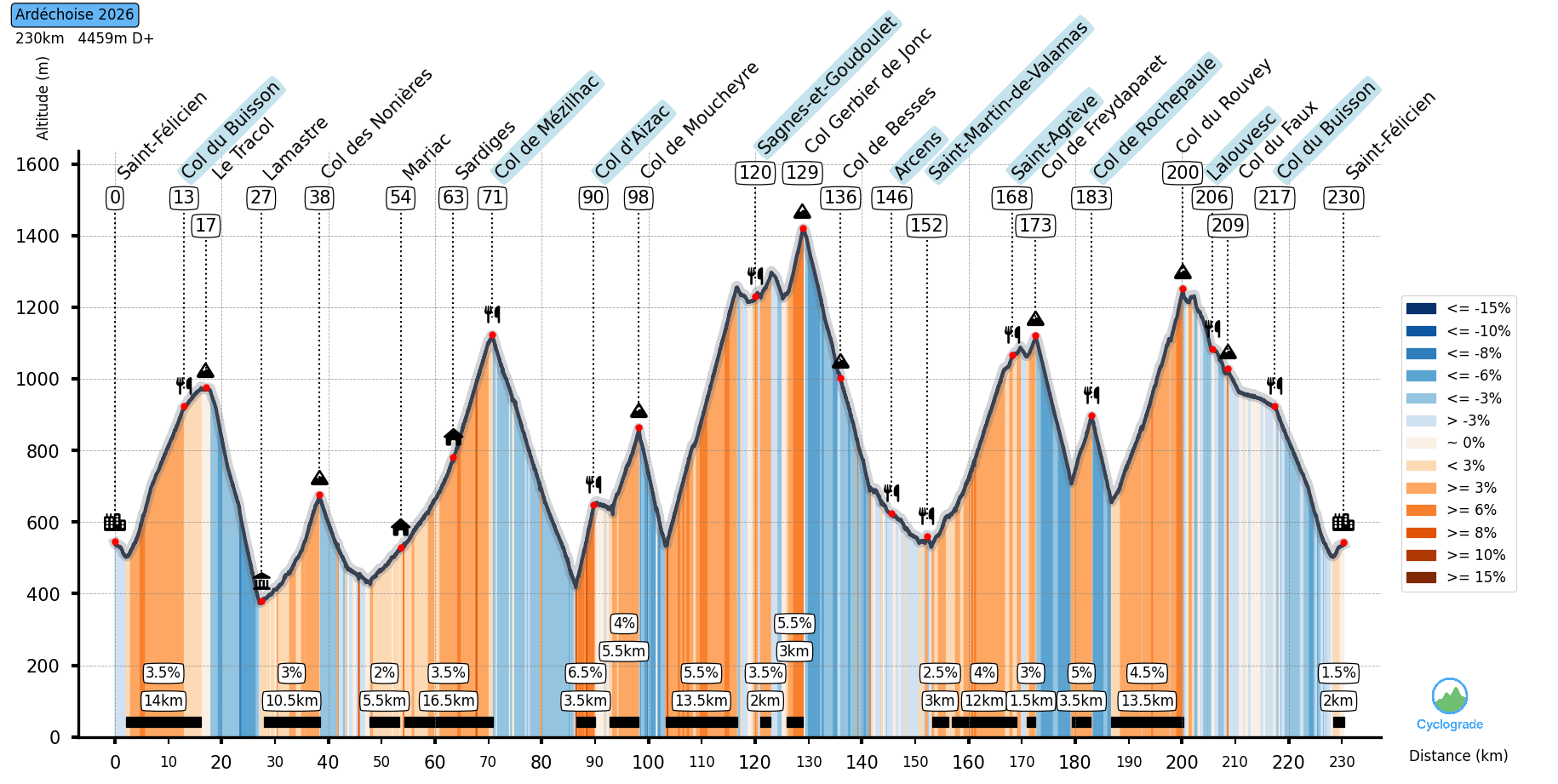
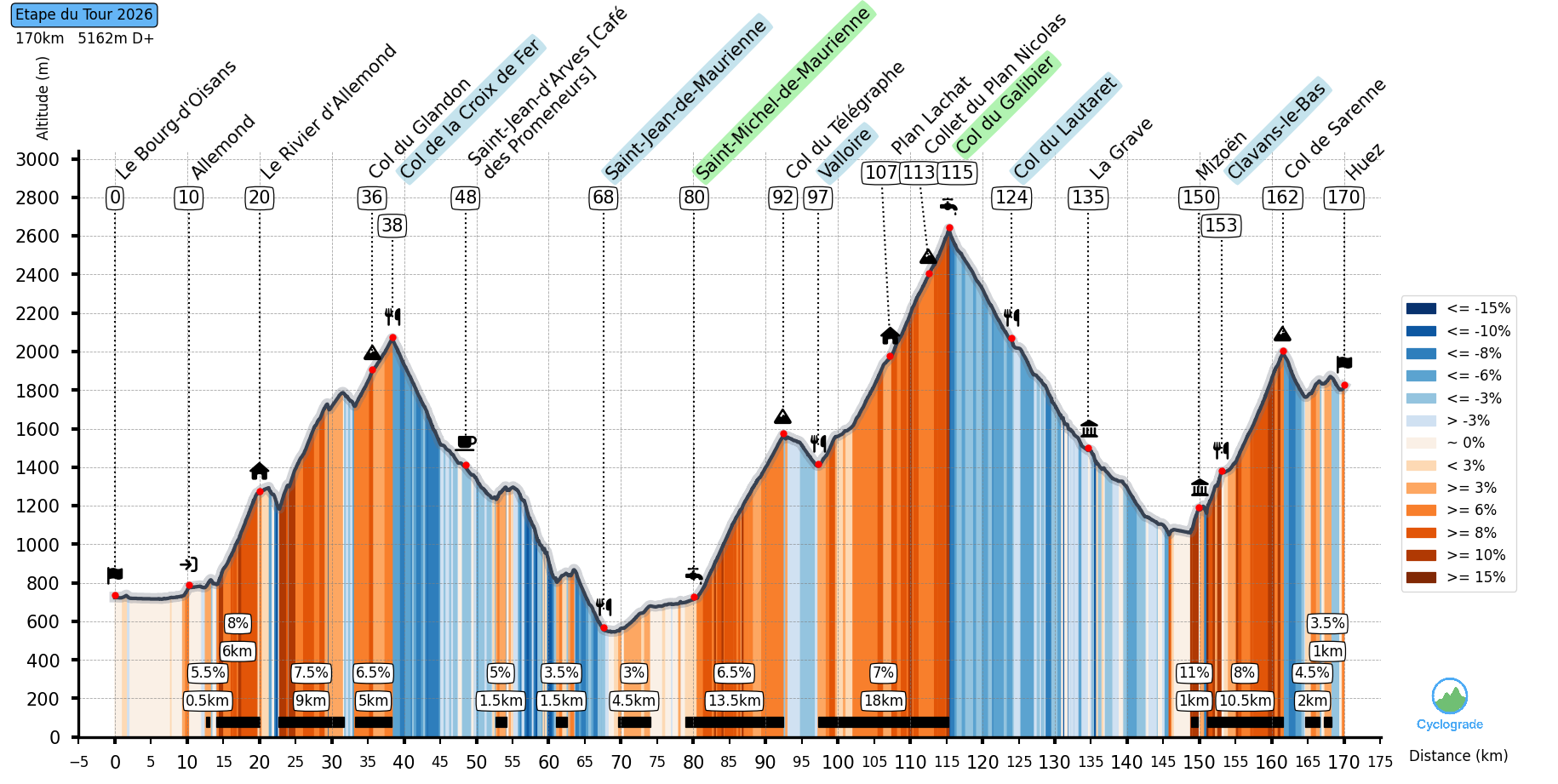
Your landmarks along the way
Cyclograde picks out landmarks at regular intervals along your track: mountain passes, and places you can spot easily in towns and villages. You can add your own points too.
Every climb broken down, profile to back it up
Gradients, distance, elevation gain — every climb is spelled out so you can pace your effort at the right moment.
Your own ride time, not a generic average
Cyclograde works out your schedule from your real level, based on your speeds. You know when you pass each landmark, when you finish, and whether you're holding your pace.
Your track on your bike computer
Export your profile as TCX and load it onto your bike computer. Every landmark with its time, plus the climbs, comes with it (Garmin only).
Get ready for your next ride
Sign up to keep your tracks, get into the catalogue and customise your profiles.